This datasets lists the 10km grid squares occurring in the UK and Ireland, as well as the Channel Islands and Isle of Man. For each 10km grid square which country(s) it occurs in, whether it is in the UK and is on land or in sea is given, as well as the latitude and longitude for the mid centroid point.
uk_ireland_tenkm_grid_squares
Format
A tibble with 11219 rows and 6 variables.
- ten_km
Ten km grid square.
- country
List of countries containing the 10km grid square.
- uk
Whether the 10km grid square is in the UK or not.
- mid_longitude
Longitude of 10km grid square centroid, to three decimal points.
- mid_latitude
Latitude of 10km grid square centroid, to three decimal points.
- geographical
Whether the 10km grid square is on land or in the sea.
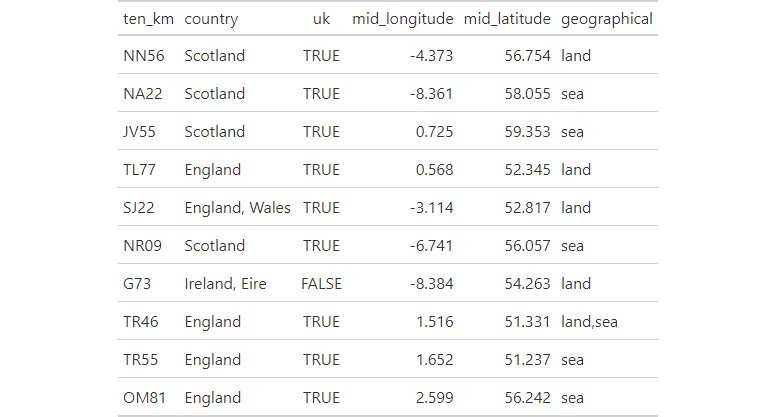
Figures
Sample of 10 rows from uk_ireland_tenkm_grid_squares dataset.
Examples
suppressPackageStartupMessages({
 library(store)
 suppressWarnings({
  library(dplyr)
  library(gt)
  library(here)
  library(fs)
  library(pagedown)
 })
})

# create figures directory
dir_create(path(tempdir(), "figures"))

# create html table
uk_ireland_tenkm_grid_squares %>%
  filter(!is.na(country)) %>%
  slice_sample(n = 10) %>%
  gt_preview(top_n = 10, incl_rownums = FALSE) %>%
  gtsave(path(tempdir(), "figures", "uk_ireland_tenkm_grid_squares.html"))

# convert to image
chrome_print(path(tempdir(), "figures", "uk_ireland_tenkm_grid_squares.html"),
             format = "png")

# move image
if(dir_exists(here("man", "figures"))) {
  file_move(path(tempdir(), "figures", "uk_ireland_tenkm_grid_squares.png"),
            here("man", "figures", "uk_ireland_tenkm_grid_squares.png"))
}